Guide
Lake of the Ozarks Vacation Rentals: Where to Stay on the Lake
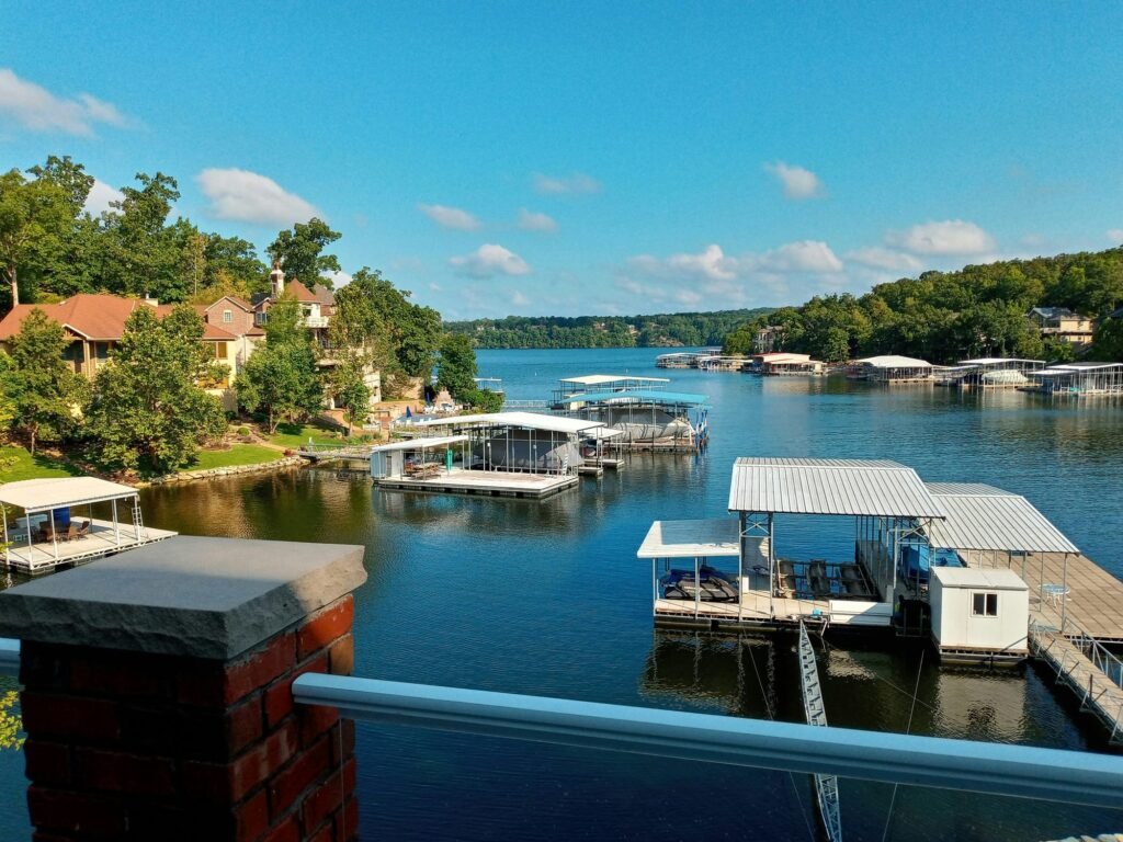
The Osage River forms near the Kansas line and flows east across west-central Missouri. In 1931 Bagnell Dam backed it up into a lake about 93 miles long, with about 1,150 miles of shoreline and four main arms, the Osage, the Niangua, the Gravois, and the Grand Glaize. Lake of the Ozarks vacation rentals are spread along all of it.
The Lake
Ameren Missouri operates the dam as a hydroelectric plant under a federal license. Its shoreline plan gives the numbers: a dam at river mile 81.7, a lake reaching upstream to the tailwater of Truman Dam, about 94 square miles of surface at normal pool, and almost 2 million acre-feet of water across Benton, Camden, Miller, and Morgan counties. The Corps of Engineers controls about 82 percent of the inflow through Truman and five other dams upstream. The dam is about 40 miles south of Jefferson City, 150 miles southeast of Kansas City, and 170 miles southwest of St. Louis.
The City of Lake Ozark counts more than 70,000 homes along the water, many of them vacation homes, and more than 3 million visitors a year. The General Assembly once named it Lake Benton. The name never took.
Building the lake moved whole towns. The Miller County Museum records that work began on August 6, 1929, with up to 4,600 workers employed at times, and that water began rising on February 2, 1931. The lake opened to boats on May 30 of that year. Camdenton and a new Linn Creek were built for families the water displaced.
Bagnell Dam
The route starts at the dam, at the east end, in the City of Lake Ozark. Ameren keeps an overlook with kiosks on the lake’s history and one of the original turbines. A walkway on the downstream side, built with the Missouri Department of Conservation, is a place to watch fish and birds in the tailwater. Just north of the dam, Willmore Lodge, a house from 1930, holds a free museum on the lake and serves as the Lake Area Chamber of Commerce’s visitor center. Go there first for maps.
U.S. 54 carries most traffic around the lake. It crosses the Osage River below the dam, passes through Osage Beach, crosses the Grand Glaize Arm on a bridge with ramps from Osage Beach Parkway, and continues to Camdenton and across the Niangua.
Osage Beach
Osage Beach reaches the Grand Glaize Arm and straddles the line between Camden and Miller counties. The city publishes the clearest rental rules on the lake. It defines a short-term rental as fewer than 30 consecutive days, sets no limit on rentals in most residential zones, and requires no business license for renting alone. R-3 multi-family zones are the exception, with a 30-day minimum. Rentals collect sales tax plus a county lodging tax of 3.0% on the Camden side of the city or 5.0% on the Miller side, as of November 2026.
Lake of the Ozarks State Park
Highway 134 leads into Lake of the Ozarks State Park, more than 17,000 acres of Ozark hills and hollows with more than 80 miles of lake frontage. The National Park Service began it in the mid-1930s and handed it to the state in 1946. Civilian Conservation Corps crews built its log buildings, rustic bridges, and stone ditch-dams, and the park and Highway 134 are now on the National Register of Historic Places.
The park has two swimming beaches, two marinas with boat rentals, paved boat ramps, and 12 trails for hiking, biking, and riding. Coakley Hollow Fen, a 1,776-acre natural area fed by cool spring water, has a boardwalk through it.
Ozark Caverns is the park’s cave, home to four kinds of salamanders, five kinds of bats, and 16 kinds of invertebrates. Its best-known feature is Angel Showers, water that seems to fall from solid rock. Traditional tours begin May 15 and end September 15. They are offered daily only from June 1 to August 15, with a shorter schedule on either side. Leave purses, backpacks, and strollers in the car. The park bans them in the cave to protect its bats from white-nose syndrome.
Camdenton and Ha Ha Tonka
West on U.S. 54, Camdenton is the town nearest the Niangua Arm. Off State Road D, with a Camdenton address, Ha Ha Tonka State Park covers a stretch of karst, ground where water has dissolved the bedrock into caves, sinkholes, and springs.
Ha Ha Tonka Spring is Missouri’s 12th largest, putting out more than 48 million gallons a day into a gorge with bluffs 250 feet high. The natural bridge is 70 feet wide, spans 60 feet, and rises more than 100 feet. The Colosseum, a sinkhole left when a cavern collapsed, measures 500 feet by 300. Trails and boardwalks link the spring, the sinkholes, and the bluff.
On top stand the ruins of a stone castle. Robert M. Snyder, a Kansas City businessman, began it in 1905 and died in one of the state’s first automobile accidents a year later. His sons finished it in 1922. It was later leased as a hotel. In 1942 sparks from a chimney set the roof alight, and the fire gutted the house. The state park was created in 1978. Two courtesy docks serve visitors who come by boat.
Water Levels
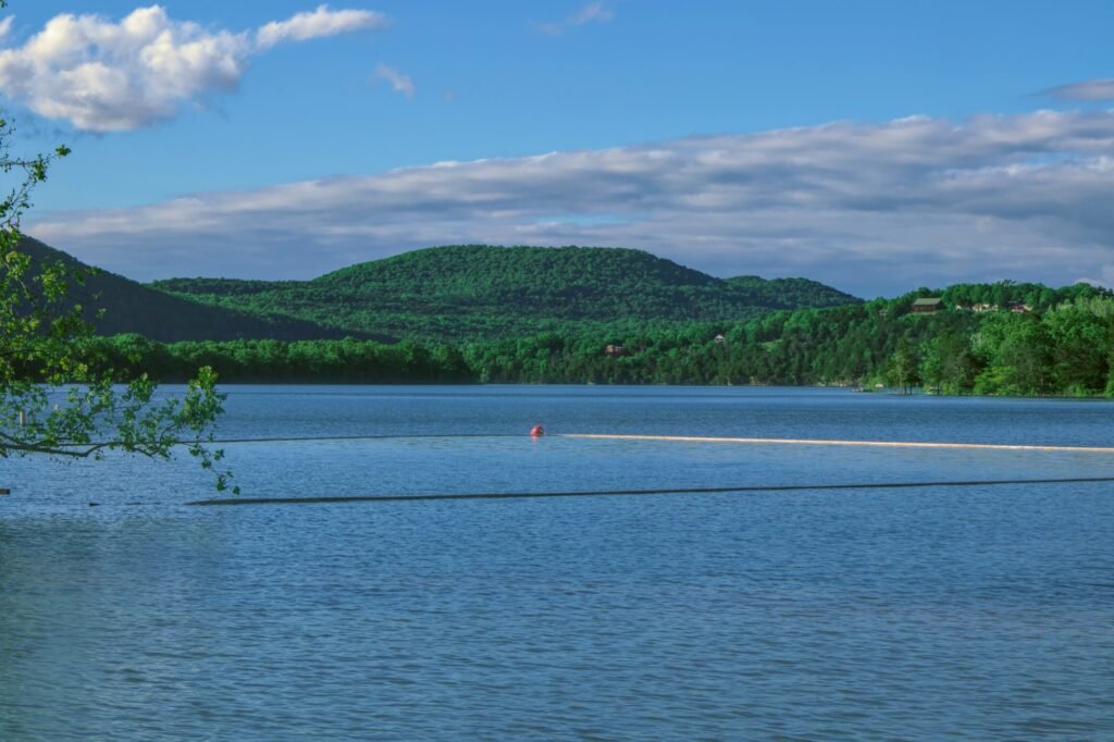
The lake rises and falls on a schedule. Ameren’s guide curve holds it at 659 feet from late May to early September and 658 feet from late September to early December. After the new year it drops to 654 feet by February 15 and stays there until April 1, to make room for spring floods, then climbs back through May. Five feet matters at a dock in a shallow cove. Ameren posts the daily level at AmerenMissouri.com/Lake and on a phone line at 573-365-9205.
Boating Rules
The Missouri State Highway Patrol’s Water Patrol Division enforces the law on the lake. Anyone born on or after January 1, 1984, who operates a motorboat or a sailboat over 12 feet on Missouri’s lakes must carry a boater safety card or a license endorsement. From January 1, 2027, anyone born on or after January 1, 2006, needs one on all state waters. Missouri accepts a NASBLA-approved card from a visitor’s home state. A one-time temporary card good for seven days can be ordered online, and boat rental businesses may issue one as well. An operator must be 14 unless an adult is aboard.
Every boat needs a life jacket for each person. Children under 7 must wear one, except inside an enclosed cabin, and personal watercraft riders must wear one whenever they are moving.
Zebra mussels are established in the lake and in the Osage below the dam, according to the Missouri Department of Conservation. Anyone trailering a boat home should clean it, drain the livewells and transom wells before leaving the ramp, and let it dry before launching anywhere else. MDC recommends a 104-degree hot-water spray after a boat has been in infested water.
Seasons
Summer brings the cave’s daily tours and a lake held at 659 feet. Missouri’s color usually peaks around mid-October, by the Department of Conservation’s count, and fades by late October. The lake is still near 658 feet then. Come in the second or third week of October for color on the bluffs, with the lake still close to full.
Do not plan a lake trip for late February or March. The water is at its lowest, the cave is closed to tours until May 15, and the boating months are still ahead.
Choosing an Arm
- Bagnell Dam and Lake Ozark: the east end, the overlook, Willmore Lodge, and the main channel.
- Osage Beach and the Grand Glaize: the state park’s beaches, marinas, and Ozark Caverns, with the lake’s clearest published rental rules.
- Camdenton and the Niangua: Ha Ha Tonka’s spring, bridge, and castle, with a dock for boaters.
- The Gravois and the upper Osage: the Gravois Arm and the long reach of the lake toward Truman Dam. Ask the host which county and town the house is in, since the rules change at each line.
Rental Rules
Rules differ by city and county. Osage Beach publishes its rules. No current rules could be confirmed on the Lake Ozark or Camden County sites. Ask the host whether the house is permitted where it stands.
Before you book, ask the host:
- What “lake access” means here: a private dock, a shared dock, or a walk to a public ramp.
- How deep the water is at the dock in your month, especially from February to April.
- What 911 address is posted on the dock, as state law requires.
- Whether a boat comes with the stay, and what card and life jackets the host expects you to bring.
- Which city and county the house is in, and which lodging tax applies.
The questions to ask a host cover the rest. Groups taking a whole house should read the large group guide.
Eureka Springs, in the Ozark Mountains of northwest Arkansas, is covered in the guide to Eureka Springs cabins. A sandstone river gorge with boat tours is the subject of the guide to Wisconsin Dells cabins.
Frequently Asked Questions
Do you need a boater safety card at Lake of the Ozarks?
Yes, if you were born on or after January 1, 1984, and operate a motorboat or a sailboat over 12 feet. Missouri accepts a NASBLA-approved card from your home state. A one-time temporary card good for seven days can be ordered online.
When is the water lowest at Lake of the Ozarks?
From February 15 to April 1, when Ameren’s guide curve holds the lake at 654 feet to make room for spring floods. From late May to early September it is held at 659 feet.
When are Ozark Caverns tours offered?
From May 15 to September 15. Tours are daily only from June 1 to August 15, with a shorter schedule on either side.
When is fall color at Lake of the Ozarks?
Missouri’s color usually peaks around mid-October and fades by late October. The second or third week of October brings color on the bluffs with the lake still close to full.
What is there to see at Ha Ha Tonka State Park?
A spring, a natural bridge, sinkholes, and the ruins of a stone castle. The spring puts out more than 48 million gallons a day. The natural bridge is 70 feet wide, spans 60 feet, and rises more than 100 feet.